Mapping Environmental History at Stanford’s Branner Earth Sciences Library
We had the opportunity to speak with Zoe Dilles, the map librarian in charge of the Branner Earth Sciences Library Map Collection. In this insightful discussion, we explored the library’s rich history, interdisciplinary resources, and the essential role it plays in supporting research in environmental history and the environmental humanities.
What is the Branner Earth Sciences Library, and how can it support research in environmental history?
The Branner Earth Sciences Library is one of Stanford’s oldest libraries. It owes its name and origins to John Casper Branner, Stanford’s first geology professor and second university president. Branner was a leader in the study of earth sciences which was one of the foundational academic areas of the university.
The collection itself grew out of Branner’s personal book donations. Over the years, it expanded to include texts on geology, environmental science, and an extensive map collection. As a federal depository library, we also house materials from the United States Geological Survey (USGS). Additionally, the library hosts the Stanford Geospatial Center, providing GIS support services across campus.
Today, the Branner Library serves as a vital resource for studying California’s interconnected histories of land, resources, and human impact—key areas of focus for environmental historians. Although currently housed under the Doerr School of Sustainability, the library supports the entire university community.
Can you tell us more about the map collection? Is it focused exclusively on California?
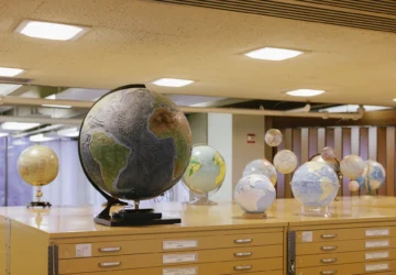
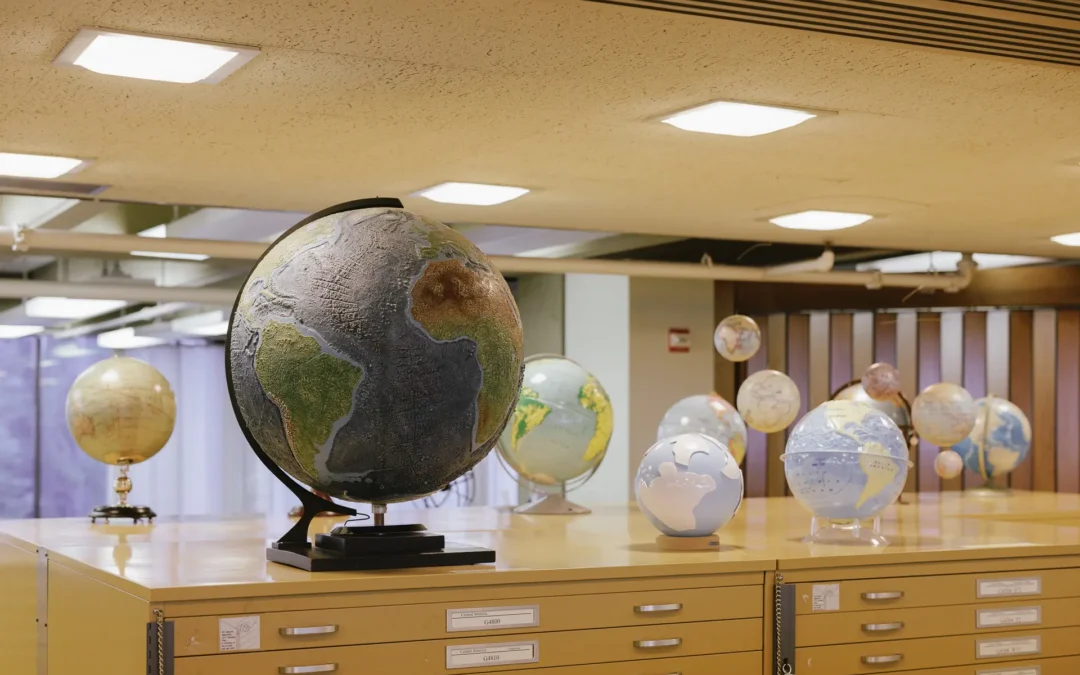
Our collection is broad and diverse. While we have a strong emphasis on California, the maps span many regions and themes, including natural resource exploration, geological formations, and forest cover. We also have collections focused on resource extraction in East Asia and Africa. These maps serve as historical records themselves, reflecting how landscapes were understood, administered, and renamed over time. For example, we hold geological maps showing rock formations, administrative maps that track changing political boundaries, and artistic maps created by advertising agencies and political activists. These maps narrate histories of power, exploitation, and environmental change.
Our collection is complemented by the David Rumsey Map Center in Green Library, which houses rare, pre-20th century maps requiring special handling, many of which are digitized and available on SearchWorks. David Rumsey, a living donor, also has an extensive digitized collection on his personal website. Together, these collections provide a comprehensive resource for cartographic and environmental history research.
How should environmental historians view and use maps as historical sources and artifacts?
Maps are powerful artifacts layered with historical, political, and cultural meanings. They reveal details beyond what is available in written records, providing insights into resource control, territorial boundaries, and environmental management strategies. Some of the maps in our collection, such as captured documents from World War II, carry stamps and markings that reflect the institutions that once controlled them.
By studying maps, researchers can uncover patterns of power, exploitation, and environmental transformation. For example, maps may show who controlled critical resources like water and minerals, how borders were negotiated, and how colonial or national powers projected their influence onto different landscapes. These dynamics are crucial to deepening our understanding of the environment and our relationship with it.
How can researchers access the maps and other resources at the Branner Library?
Visitors to the Branner Library can browse the physical collection during our open hours, generally from 9 a.m. to 6 p.m. during the week, with shorter hours on Fridays and Sundays. Many maps are organized by call number and are part of a circulating collection, allowing for hands-on exploration.
About half of our map collection is stored off-site. Researchers can request these materials through Stanford’s SearchWorks catalog. Once requested, the maps are delivered to the library for viewing. For researchers who cannot visit in person, we offer a robust digitization program. Many maps are scanned and available online through Stanford’s Digital Repository.
What kind of support does the library offer for scholars unfamiliar with maps?
Our goal is to make these resources accessible to people from all disciplines. Maps can be intimidating if you’ve never worked with them before—they are large, visual artifacts that can be difficult to search and interpret compared to text-based documents.
We provide workshops and one-on-one consultations to help researchers navigate the collection. For example, we offer training on GIS tools like ArcGIS and QGIS, enabling users to analyze spatial data and create their own maps. The Stanford Geospatial Center also supports both digital and paper-based spatial data research. Additionally, we run publication cartography workshops, teaching researchers how to design visually compelling maps for dissertations and journal articles.
Could you share an example of a researcher who discovered something unexpected in your collection and how it helped them in their research?
One story that comes to mind involves a history student studying an expedition in mid-19th century East Africa. She had read about an expedition in a journal but had never seen the accompanying map. We located a reproduction of the map in our collection, which added a new dimension to her research.
Discoveries like that are always exciting. Maps can reveal details that aren’t obvious from written accounts alone. By tracing geographic features and place names, researchers gain new insights into how people interacted with the environment and how landscapes evolved over time.
What advice would you give environmental historians who want to use maps in their work?
Don’t hesitate to reach out to librarians! We’re here to help—whether you need guidance with research or just want to explore the collections. Maps can tell stories in ways other resources can’t, and there’s something here for everyone.
To get started, explore the SearchWorks catalog and filter by “resource type: map.” You’ll find a variety of materials, including atlases, carto-bibliographies, and both digital and paper maps. Items stored off-site can easily be requested for viewing on site.
If you have any questions or need further assistance, feel free to contact me at zdilles@stanford.edu or reach out to any member of our staff.